

File:Antalya VFR CHART REDUCED.jpg: Difference between revisions
No edit summary |
(2017242 uploaded a new version of File:Antalya VFR CHART REDUCED.jpg) |


Latest revision as of 15:33, 8 November 2026
Antalya Airport VFR Chart showing waypoints and VFR corridors/routes.
File history
Click on a date/time to view the file as it appeared at that time.
| Date/Time | Thumbnail | Dimensions | User | Comment | |
|---|---|---|---|---|---|
| current | 19:58, 8 November 2026 |  | 1,600 × 1,121 (807 KB) | 2017242 (talk | contribs) | Updated AIRAC, new waypoints. |
| 07:38, 26 July 2023 | 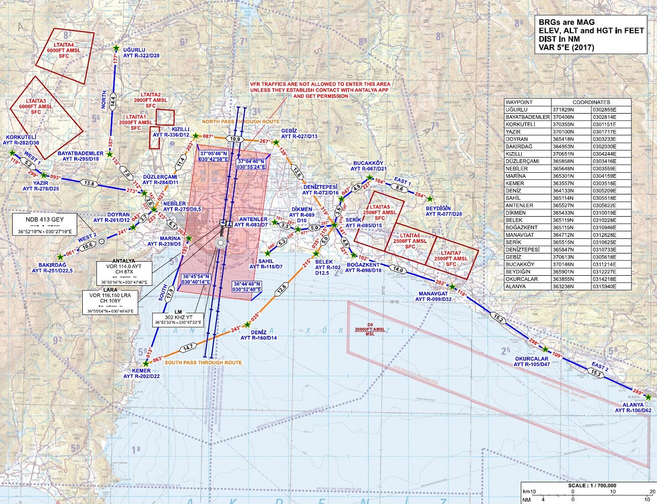 | 1,302 × 998 (691 KB) | Trvacc (talk | contribs) |
You cannot overwrite this file.
File usage
The following page uses this file:
